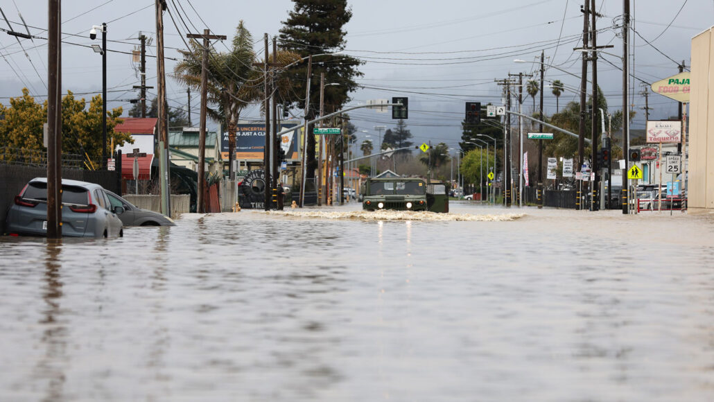
These drenching storms are pummeling the U.S. West Coast, bringing dangerous flooding and snow
By Carolyn
The term “atmospheric river” may sound airy and ethereal, but these massive, fast-moving, drenching storms can hit as hard as a freight train. Since December, the U.S. West has been slammed with back-to-back-to-back atmospheric rivers, the most recent one deluging the state March 15 and another forecast to hit the state in the coming week. These powerful streams of water vapor arrive with strong winds, heavy rains and thick snow, spawning flooding, landslides and avalanches.
Big as they are, these storms are surprisingly tough to see coming. A week’s warning is about the best forecasters can do now.
A team of scientists is trying to change that. In just the past few months, they’ve flown more than three dozen reconnaissance missions into the storms. They’ve launched dozens of weather balloons high into the stratosphere, each carrying instruments to measure temperature, moisture, air pressure and wind. And the scientists have crunched reams of data and run hundreds of computer simulations, all to forecast when the next atmospheric river is going to arrive and how intense it’s likely to be.
The goal of this effort, the team says, is to improve predictions, to give the people in the storms’ path more time to prepare for flooding, and ultimately to find ways to manage the water for the region’s drier months.
It’s a big task, particularly during this year’s seemingly relentless barrage of storms. “We have been hammered here: December, January, February, March,” says meteorologist Marty Ralph. “It has been a long and active season.”
In just December and January, nine atmospheric rivers hammered western United States and Canada relentlessly, dumping record rain and snow across the region. Over 121 billion metric tons of water fell on California alone, according to the U.S. National Environmental Satellite Data and Information Service.
And this task is likely to become even more challenging, given lingering uncertainty over how atmospheric rivers will shift in intensity and frequency as the planet continues to warm.
Rivers in the sky
Atmospheric rivers are long, narrow bands of condensed water vapor, typically around 1,500 kilometers long and 500 kilometers across . The streams form over warm ocean waters, often in the tropics, and snake through the sky, transporting huge amounts of water. One atmospheric river, on average, can transport up to 15 times the volume of water at the mouth of the Mississippi River. When these storms arrive over land, they can release that water as rain or snow.
While atmospheric rivers can bring welcome water to a parched region, they also are “the primary, almost the exclusive” cause of floods on the U.S. West Coast, says Ralph.
In 2013, he and colleagues created the Center for Western Weather and Water Extremes, or CW3E, at the Scripps Institution of Oceanography in La Jolla, Calif. The group then created the first weather model tailored to predicting atmospheric rivers on the U.S. West Coast. This year, the team also created an atmospheric river intensity scale, ranking the events based on size and how much water they’re carrying.
To improve their forecasts of landfall and intensity, the team collects data from drifting ocean buoys, weather balloons and airplanes. The group even enlisted the aid of the U.S. Air Force’s hurricane hunters — most famous for flying into the eyes of tropical cyclones from June to November — to do aerial reconnaissance .
The data collected by the planes fill an important information gap, says Anna Wilson. She’s a Scripps atmospheric scientist who also manages field research for CW3E. Weather balloons are the workhorses of weather prediction, but they’re launched over land, and “it’s important to see what happens before [an atmospheric river] makes landfall,” Wilson says.
Satellites can provide valuable atmospheric data over the ocean, but they generally can’t see through clouds and heavy precipitation, both characteristic features of atmospheric rivers. And atmospheric rivers hang low in the troposphere, the lowest part of Earth’s atmosphere, making it even harder for satellites to spy on them.
During each flight mission, the planes drop instruments called dropsondes that collect temperature, moisture, wind and other data as they fall. Since November 1, the hunters have flown 39 missions into the atmospheric rivers, Wilson says.


Follow us